|
|
|
|
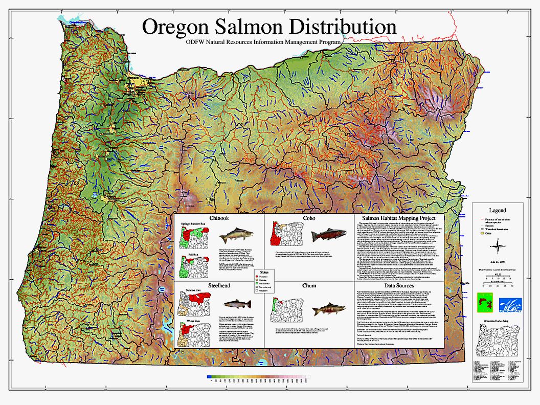
| The purpose of this map is to improve the understanding of where salmon are found throughout the state of Oregon. Typically, the data have been mapped one species and one watershed at a time. This past approach resulted in 196 maps to cover the total distribution of the 4 anadromous salmonid species (excluding sea-run cutthroat). Access to the Oregon Department of Fish and Wildlife (ODFW) salmonid distribution data can be cumbersome. The data are made available in GIS format or can be accessed via 196 separate PDF map files via the web. By providing a single, statewide map of ODFW's salmon distribution data, hopefully more people will become aware of the geographic extent of Oregon's salmon and consequently modify their behavior to preserve this precious resource. |